
|
A brief listing of
some of the products, procedures and routines,
that G.E.M.S. has been
involved in developing:
|
|
|
A brief listing of
some of the products, procedures and routines,
that G.E.M.S. has been
involved in developing:
|
This is an area where we are placing various documents, spreadsheets etc. for all to use.
We call these items Beerware, absolutely free for use.
If you are so fascinated by it, or find it very useful, and want to pay for it,
you are encouraged to buy the author a beer (or two) when you next meet them.
Our standard disclaimer:
This distribution is provided "as is", without any guarantee made as to its suitability
or fitness for any particular use. It may contain bugs, so use is at your own risk.
Author takes no responsibility for any damage that may unintentionally be caused through its use.
|
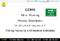
Presentation: GEMS Mine Planning Process This is the GEMS 8 phase Mine Planning process in regards to JORC 2012. (500KB PDF) |
|
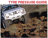
Cooper tires 4WD Drivers Guide Cooper tires 4wd Drivers Guide provides handy information relating to tire pressures in various on-road, and off-road conditions. The 4psi rule is useful to those who have active tyre pressure sensors fitted. (900KB PDF) |

|
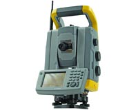
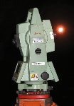
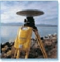
Trimble S6 Users Guide Trimble S6 Series Total Station User Guide, Version 03.00, Part Number 57127002, June 2006. (2.7MB PDF) |

|
Trimble Access Software Help Manual Trimble Access Software - General Survey, Version 1.40, Revision A, October 2010. (1.7MB PDF) |

|
Trimble Access Software - Mines Module - Help Manual Trimble Access Software - Mines Module, Version 1.20, Revision A, December 2009. (530Kb PDF) |
|
|
Trimble S6/8 Underground Surveying Style Sheet Procedure This procedure details how to use the Trimble S6/S8 total station to complete routine underground surveying tasks including: standard station setup, resection, forward station establishment, feature surveys and extended rod drillhole surveys. The field procedure relies on the use of the GEMS_UGv2.0.xsl style sheet to export data from the TCU to allow straightforward processing in Gemcom Surpac using Geodat 600 data recorder function. Please contact us regarding implimenting its use. (460Kb PDF) |
|
Trimble S6/8 Prism Monitoring Procedure The purpose of this procedure is to describe the method to complete an automated prism monitoring with the Trimble S6 or S8 total station, in a typical open pit mining environment. The scope of this is document is for all mine sites using Trimble S6 or S8 total stations, in conjunction with SoftRock Quikslope software. (360Kb PDF) |
|
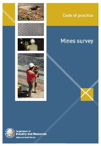
WA Mine Survey - Code of Practice - 2005The code of practice published by West Australian Mines Department at the time, for Mine Surveyors. Although only treated as a suggested guideline by many, at GEMS we incorporate all aspects of this document as part of our self-imposed Survey Standards. (510Kb PDF) |
|
Prism Monitoring Spreadsheet An Excel spreadsheet which queries the Quikslope database and tabulates and graphs data. The advantage of this addition is that this can be submitted to others, whether they be Geotechnical consultants or Managers for review, without the requirement for them to have Quikslope software and be familiar with its use. Please contact us regarding implimenting its use. (280Kb xls) |

|
Reconciliation Calculator
Software 500KBThis calculator balances out, or reconciles/adjusts mining stockpile, loading, trucking, and milling figures. The adjustment is a weighted one, based on the precision of the input data. |
|
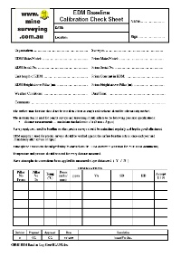
EDM Baseline Calibration Check Sheet Survey equipment used for baseline or other precise surveys should be maintained regularly and kept in good adjustment. EDM equipment used for precise surveys should be verified against the surface baseline at least once each year and immediately after service or repair. This log sheet (120Kb PDF) is for documenting the measurements. |

|
Redfearns Formula A simple Excel spreadsheet for converting between GDA and MGA. Using Redfearns formula the (XLS 70kb) file was sourced from the Intergovernmental Committee on Surveying and Mapping (ICSM) web site GDA Technical Manual and Transformation Software page. See www.icsm.gov.au/icsm/gda/gdatm/ |
|
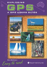
Exploring GPS 2,800KBThis GPS user guide is a worthwhile read for those wanting a slightly better than average understanding. Found this on the NSW Dept. of Lands web site, where a download is available, as well as on our web site . |

|
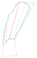
Dumped Ring Design & Survey Markup Notes for Solo 7-15F 1.9MBThis MS Powerpoint show illustrates how the slicing (centreline, reference) line placement, and laser line markups can affect the actual collar position. |
|
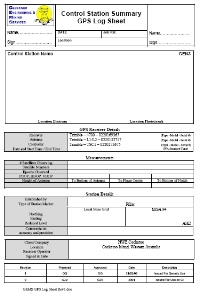
GPS Station Log Sheet 80KBThis is a log sheet aka survey station summary sheet for GPS readings on a point. |
|
GEMS Survey Standards Document Prior to the WA Mine Survey - Code of Practice, and at the simular time of the NSW MR Directions for Mine Surveyors, at GEMS we documented a series of self-imposed standards which the team are at minimum to adhere to. This document undergoes revisions to continually "raise the bar". (200Kb PDF) |

|
NSW MR - Survey and Drafting Directions for Mining Surveyors - 2003 This document outlines the statuatory requiremnts imposed by New South Wales Mineral Resources section - Survey and Drafting Directions for Mining Surveyors. (400Kb PDF) |
|
The WA 1996 Guidelines for Mining in Arid Environments 800KBAlthough now superseded, it is a handy document that is often difficult to locate on government web sites. See items in it such as dump construction that allows progressive rehabilitation whilst the dump is being constructed. |
|
Procedure: #20030715
Re-Calc Macro for Traverse Ledger This procedure describes a macro that has been made up to enable the re-calculation of survey station coordinates within a traverse ledger, to be more easily performed. |

|
Procedure: #20030713
Geodimeter 468DR Instrument Settings This procedure describes how to check, and change some of the instrument settings for a Geodimeter 468DR. |
|
Procedure:
#20030711 Leica TCRA1103 Instrument Settings This procedure describes how to check, and change some of the instrument configuration settings in the Leica TCRA1103. |

|
Procedure: #20030603
Free-Station Calculation Macro
This procedure describes a routine for post processing a free-station resection using SSI-v5.0, from field notes. It applies to Surpac Vision 5.0-A, for both underground and surface free stations or resection. |
|
Trimble RTK GPS Mine Site Calibration
This procedure describes the steps required to complete a RTK Site Calibration. |
|
Procedure: #20030212 Surpac
CMS Processing for Stope ReconciliationsAn Optec CMS (Cavity Monitoring System) survey produces a series of surveyed points outlining the actual shape of a void left by a stope, drive or some other opening. |

|
Procedure: #20020528 Surpac
CMS Processing for Stockpiles and Open PitsThis procedure describes a way of using an Optec CMS (Cavity Monitoring System) to survey a stockpile, and process the data into a useable format in Surpac software. |
|
Procedure: #20020305
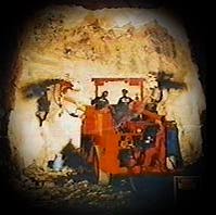
UG Jumbo Drilling Direction Markup
These notes are compiled to assist in marking up an underground heading. |

|
Surpac String Numbering
Convention:
Based on the Australian Standards feature codes and industry adopted defaults, this is a listing that has been developed over the past decade. |

|
Product Development: Underground Survey Station Reflectors (Delineators)
|
|
|
| Back to Intro |